Surveyor Technician
Qualifications:
BUD.18 Carry out situational, altimetric and realisation measurements and develop the results of these measurements,
BUD.19 Performing surveying work related to cadastre and real estate management.
General description:
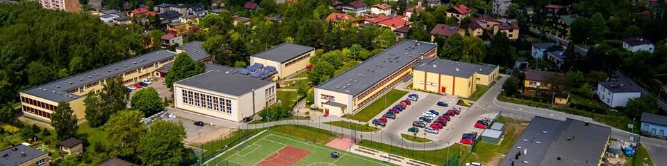
NEW POSSIBILITIES : Surveying with drones!
The diploma of surveying technician is awarded to the graduate after passing the qualification confirmation exam, which is held in two stages: at the end of the second semester of third grade and the end of the first semester in fourth grade. Students have the opportunity to benefit from international exchanges and internships abroad. The teaching plan includes an extension in mathematics and geography.
We are an examination centre. Our students take examinations for professional qualifications on the equipment they use in their classes. We teach versatile software e.g. AutoCad, which is used in many technical fields and provides employment opportunities in various industries. We use modern surveying techniques e.g. drones, GPS
and electronic total stations. The surveyor makes use of data sent by satellites and uses
specialised surveying and design software in their work.
The knowledge of surveying has applications in:
construction,
spatial planning
property valuation
mineral exploration,
navigation,
military,
cartography,
mining,
agriculture,
aerial and satellite image authentication,
real estate management,
management of utility networks.
Surveyors find employment
in numerous surveying companies,
in construction companies (road, rail, housing, industrial construction, etc.),
in governmental and local administration units
running their own business
When continuing their higher education, they often study property surveying or architecture in addition to surveying.
The development of geodesy has led to the need to define its new tasks related to
with geoinformatics (processing digital images and using databases with the help of various IT tools), GIS (geographical information systems associated with
with the analysis and processing of spatial data using various IT systems and 3D modelling – Numerical Terrain Models) or working with unmanned aerial vehicles – drones used in various industries, e.g. surveying and cartography, photography, energy, environmental protection, mining, construction, geology, agriculture.
A surveying technician is one of the few professions to have the opportunity to gain professional qualifications without a university degree. In addition to working within national borders, there is a huge demand for surveyors in Sweden, Germany and the UK.
Surveying is therefore the profession of the future.
You can observe what we learn and what our classes are like and the atmosphere in the surveying classes on Facebook: https://www.facebook.com/ZSB-Rybnik-geodezja-1296925360421665/
BUD.18 Carry out situational, altimetric and realisation measurements and develop the results of these measurements,
BUD.19 Performing surveying work related to cadastre and real estate management.
General description:
NEW POSSIBILITIES : Surveying with drones!
The diploma of surveying technician is awarded to the graduate after passing the qualification confirmation exam, which is held in two stages: at the end of the second semester of third grade and the end of the first semester in fourth grade. Students have the opportunity to benefit from international exchanges and internships abroad. The teaching plan includes an extension in mathematics and geography.
We are an examination centre. Our students take examinations for professional qualifications on the equipment they use in their classes. We teach versatile software e.g. AutoCad, which is used in many technical fields and provides employment opportunities in various industries. We use modern surveying techniques e.g. drones, GPS
and electronic total stations. The surveyor makes use of data sent by satellites and uses
specialised surveying and design software in their work.
The knowledge of surveying has applications in:
construction,
spatial planning
property valuation
mineral exploration,
navigation,
military,
cartography,
mining,
agriculture,
aerial and satellite image authentication,
real estate management,
management of utility networks.
Surveyors find employment
in numerous surveying companies,
in construction companies (road, rail, housing, industrial construction, etc.),
in governmental and local administration units
running their own business
When continuing their higher education, they often study property surveying or architecture in addition to surveying.
The development of geodesy has led to the need to define its new tasks related to
with geoinformatics (processing digital images and using databases with the help of various IT tools), GIS (geographical information systems associated with
with the analysis and processing of spatial data using various IT systems and 3D modelling – Numerical Terrain Models) or working with unmanned aerial vehicles – drones used in various industries, e.g. surveying and cartography, photography, energy, environmental protection, mining, construction, geology, agriculture.
A surveying technician is one of the few professions to have the opportunity to gain professional qualifications without a university degree. In addition to working within national borders, there is a huge demand for surveyors in Sweden, Germany and the UK.
Surveying is therefore the profession of the future.
You can observe what we learn and what our classes are like and the atmosphere in the surveying classes on Facebook: https://www.facebook.com/ZSB-Rybnik-geodezja-1296925360421665/